Why do storms in Vietnam so often hit the central region?
There is an old Vietnamese saying, "He may spare us, but she will not / Bringing floods on the 23rd of the tenth lunar month", a reminder and a warning that the flood season in the provinces from Thanh Hóa, in north-central Vietnam, southward usually runs from early July to October each year. So why is it always central Vietnam, and what drives these powerful storms? Let's find out.
According to specialized studies of storms in central Vietnam, many factors, both natural and human-made, have turned this narrow "central strip" of the country into the main target of some of the most powerful storms on record.
Big storms have geographical roots
A storm can form only when three conditions are met: heat, moisture and a dynamic force to generate rotation.
Storms and tropical depressions are most active in summer and autumn: from June to November in the Northern Hemisphere and from December to March of the following year in the Southern Hemisphere. Storms are most frequent in these seasons because this is when all the most favorable conditions for their formation and growth come together: high sea surface temperatures (at least 26oC), a tropical atmosphere that readily supports convection, and fairly vigorous large-scale rotating motion.
Storms form in the tropics because this natural phenomenon needs very warm water, at least 26 degrees, down to a depth of at least 50m. Storms usually form near the equator and tend to move toward the Earth's 2 poles, speeding up the farther they travel, so areas close to the equator are rarely affected by them.
In essence, a storm is a way of "venting heat" from the ocean. Most storms travel along the edges of high-pressure systems and are drawn toward low-pressure areas. In Vietnam, during the months when the sea surface holds the most energy (July, August and September), a low-pressure trough usually lies across central Vietnam, so storms tend to follow that path.
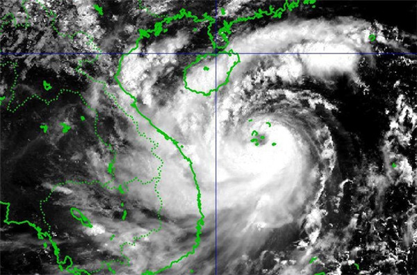
Satellite image of a storm.
In other words, central Vietnam has a harsh climate because it is exposed to the southwest monsoon. This wind carries a lot of moisture (having passed over the Indian Ocean), so it often brings rain. Because of this monsoon, storms that form over the East Sea are pushed northward. In later months the wind weakens, so storms tend to shift gradually toward central Vietnam.
Every year, sea storms and the northeast monsoon bring heavy rain to central Vietnam. On top of that, global climate fluctuations such as El Nino and La Nina also make sea storms and heavy rainfall more severe.

The storm season usually lasts from July to November, with an average of 5 - 8 storms a year.
The storm season usually lasts from July to November, with an average of 5 - 8 storms a year. Between 2006 and 2017, central Vietnam was hit by 7 major storms, many tropical depressions and dozens of northeast monsoon surges. These sea storms and tropical depressions often form over the western Pacific Ocean east of the Philippines or over the East Sea itself. After traveling for 3 or 4 days, they reach Vietnam's coast.
Storms over the uplands and the lowlands cause widespread flooding
Compared with the south and the north, central Vietnam's economy is relatively underdeveloped. People in the region are used to the scene of "In the seventh month, water leaps onto the banks" because "Heaven sends floods every year".
The central coastline is 1200 km long and covers the provinces from Thanh Hoá to Bình Thuận, in south-central Vietnam. The Trường Sơn mountain range (Annamite Range) runs the length of the coast, leaving only very narrow plains. The region also has a dense network of large rivers and canals, such as the Gianh River in Quảng Bình province, the Thạch Hãn River in Quảng Trị province, the Hương (Perfume) River in Huế-Thừa Thiên, the Thu Bồn River in Quảng Nam province and the Trà Khúc River in Quảng Ngãi province,...
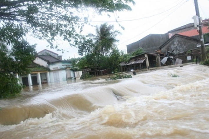
River mouths are often silted up, hampering floodwater drainage from the plains.
There are many rivers and streams, but most are short and steep. Their basins are mostly hills and mountains, so rainwater runs off very quickly. River mouths are often silted up, hampering floodwater drainage from the plains.
Floods have also caused enormous damage to homes, crops, bridges, culverts and roads, making life even harder in the already struggling central strip. Trapped in a vicious cycle of storms and floods, the region faces major obstacles to economic development.
So why are the floods so destructive?
Although local authorities and residents have actively worked to prevent, respond to and recover from storm and flood damage, the consequences are still very severe. The first reason is that heavy rain and floods strike repeatedly over large areas and last for many days.
Besides the main cause, storms over the uplands and the lowlands, several other factors are often cited, such as deforestation, sand and gravel mining, and the system of dikes and dams.
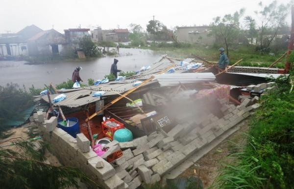
Storms and floods take a heavy toll on people's lives.
Research and surveys in the United States and many other parts of the world have shown that the leading cause of flooding is too much rain falling in a short period of time. Meanwhile, deforestation can directly contribute to flooding in narrow river basins like those in central Vietnam. Trees hold water and reduce soil erosion and landslides. When forests are cleared, bare land lets water wash away soil and rocks, raising water levels downstream.
Uncontrolled sand and gravel mining in rivers also makes flooding worse. It causes serious erosion and collapse along many stretches of riverbank. Collapsing banks and silted-up river mouths obstruct drainage, making floods bigger and longer-lasting.
Unlike the Red River in the north and the Mekong (Cửu Long) River in the south, the rivers of central Vietnam have no flood-control dike systems. Nor are there large reservoirs upstream to reduce flooding on the plains. As a result, densely populated areas along both riverbanks always face the risk of inundation when heavy storms hit.
In short, the main cause of storms and floods in central Vietnam is that storms forming over the East Sea, together with the northeast monsoon, find the region's weather patterns well suited to steering the storm's eye along this path. That is why the central provinces bear the brunt of severe natural disasters. Other factors such as deforestation... only make the flooding worse.

How many climate zones are there on Earth, and which one is Vietnam in?
Earth has five climate zones based on latitude. Here is how they differ, and why Vietnam has a tropical monsoon climate.

Why does Vietnam have a humid tropical monsoon climate?
Vietnam's climate is hot but not arid like North Africa's, and humid but not humid year-round like the archipelagos of Southeast Asia.

Mysterious lake found "hanging" inside Thung Cave in Vietnam
A mysterious lake perched about 15 m above an underground river has been found in a side passage of Thung Cave in Phong Nha-Kẻ Bàng National Park.

22 new caves discovered in Vietnam's Phong Nha-Kẻ Bàng
Explorers have found 22 new caves in Phong Nha-Kẻ Bàng, Vietnam's "kingdom of caves," said to rival the 400 caves discovered there before.

22 stunning new caves discovered in Vietnam's Quảng Bình
British cavers found 22 new caves totaling 11.7 km in Quảng Bình (now part of Quảng Trị), including two in Phong Nha-Kẻ Bàng National Park.
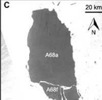
Why a 3,900-square-kilometer iceberg broke apart
Shifting ocean currents in the Southern Ocean may have caused the giant iceberg A68a to break apart, a Princeton University study suggests.