The 8 longest rivers in Vietnam
Vietnam's heavy rainfall has given rise to an enormous number of rivers and streams — around 2,360 rivers and canals, large and small. Along the coast there is a river mouth roughly every 23 km, and records count 112 river mouths opening to the sea. Vietnam's major rivers usually rise beyond its borders, with their middle and lower courses flowing through Vietnamese territory. Most of the country's rivers run northwest to southeast and empty into the East Sea.
Note: Administrative names (provinces, districts) in this article reflect the period before Vietnam's administrative reorganization of 1 July 2025, when many provinces were merged and the district level was abolished.
The longest rivers in Vietnam
1. Đồng Nai River
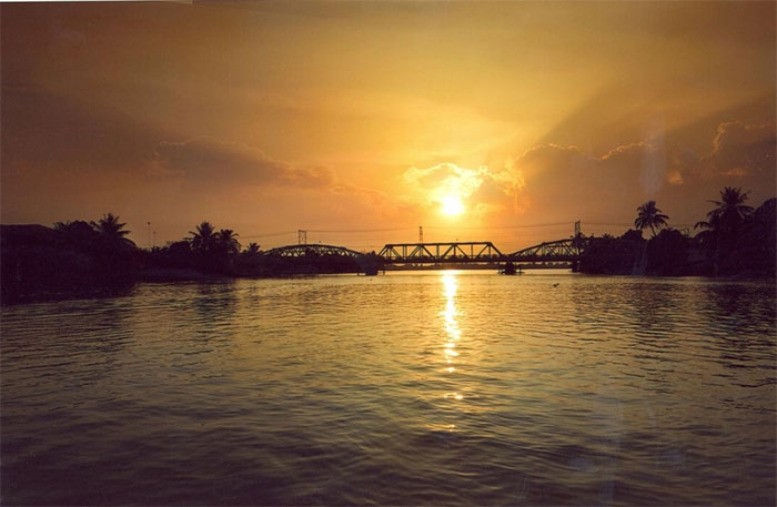
The Đồng Nai is the longest river flowing entirely within Vietnam.
It is the longest river flowing entirely within Vietnam. The Đồng Nai rises on the Langbiang Plateau in Lâm Đồng province, in Vietnam's Central Highlands, and has a total length of 586 km. With its enormous water flow, it is an abundant source of hydropower for the Đồng Nai hydropower plants. The river runs through Lâm Đồng, Đăk Nông, Bình Phước, Đồng Nai and Bình Dương provinces and Ho Chi Minh City over a length of more than 437 km, with a basin of 38,600 km². Measured from the headwaters of the Đa Dâng River it is 586 km long, while measured from its confluence with the Đa Nhim River below Pongour Falls it is 487 km long. The Đồng Nai empties into the East Sea in the Cần Giờ district area.
Upstream, the main stem of the Đồng Nai is also called the Đa Dâng River. Starting from the Lâm Viên Plateau, it meanders northeast to southwest, leaving the mountains and reaching the plains at Tà Lài (Tân Phú district, Đồng Nai province). The river forms a natural boundary between Đăk R'Lấp (Đắk Nông) and Bảo Lâm – Cát Tiên (Lâm Đồng), between Cát Tiên and Bù Đăng (Bình Phước) – Tân Phú, and between Tân Phú and Đạ Tẻh.
After meeting the Bé River, the Đồng Nai becomes a natural boundary between Đồng Nai (Vĩnh Cửu) on the left, eastern bank and Bình Dương (Tân Uyên) on the right, western bank. At Uyên Hưng ward in Tân Uyên town, Bình Dương province, the river turns north to south, wrapping around Tân Uyên islet and Cù Lao Phố. Cù Lao Phố on the Đồng Nai was a bustling center of the Minh Hương (ethnic Chinese) community before the area became an official administrative unit of Đàng Trong (the southern realm of the Nguyễn lords) in 1698.
The Đồng Nai flows through Biên Hòa city, then along the boundary between Đồng Nai (Long Thành, Nhơn Trạch) and Ho Chi Minh City (District 9, District 2, District 7, Nhà Bè, Cần Giờ), and between Bà Rịa – Vũng Tàu (Phú Mỹ) and Ho Chi Minh City (Cần Giờ). The lower main stem, from the Saigon River confluence to where it splits into the Soài Rạp and Lòng Tàu, is commonly called the Nhà Bè River. Old texts called it the "Phước Bình".
2. Đà River (Black River)
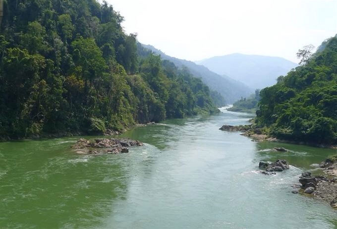
The main stem of the Đà River enters Vietnam at Mù Cả, Mường Tè.
The Đà River, also known as the Bờ River or Đà Giang, is the largest tributary of the Red River. It is 910 km long (some sources say 983 km), with a basin of 52,900 km². The main stem rises in the Wuliang Mountains of Yunnan province, China, and flows northwest to southeast before joining the Red River in Phú Thọ. The Vietnamese section is 527 km long (some sources say 543 km). It begins at the Vietnam–China border in Mường Tè district (Lai Châu) and runs through the northwestern provinces of Lai Châu, Điện Biên, Sơn La, Hòa Bình and Phú Thọ (separating Thanh Thủy district, Phú Thọ, from Ba Vì, Hanoi). It ends at the Hồng–Đà confluence in Tam Nông district, Phú Thọ province.
The main stem of the Đà enters Vietnam at Mù Cả, Mường Tè. On its first stretch in Vietnamese territory, the river, also called the Nậm Tè, runs along the border and meets the Tiểu Hắc tributary at Mù Cả, Mường Tè. The Tiểu Hắc enters Vietnam at Ka Lăng commune, Mường Tè, flows west along the border and joins the main stem of the Đà at Mù Cả.
The Đà carries a large volume of water, supplying 31% of the Red River's flow, and is a major hydropower resource for Vietnam's electricity industry. In 1994, the Hòa Bình Hydropower Plant was inaugurated, with a capacity of 1,920 MW from 8 generating units. In 2005, construction began on the Sơn La hydropower project, with a design capacity of 2,400 MW. The 1,200 MW Lai Châu hydropower plant was built on the river's upper reaches. Construction began in 2011 and was completed in December 2016. The basin holds enormous resource potential, with many rare minerals and distinctive ecosystems rich in highly diverse living organisms.
3. Red River (Sông Hồng)
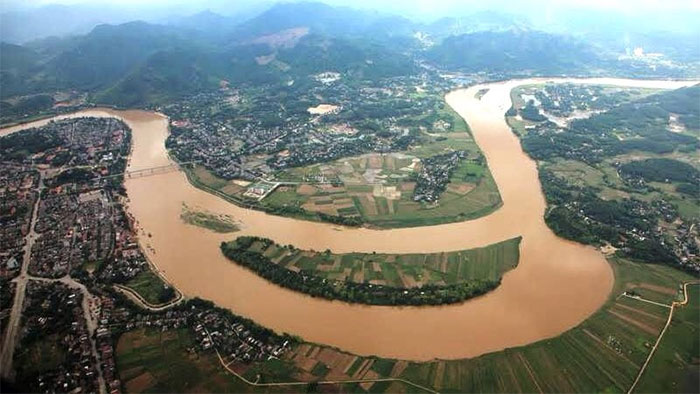
The Red River has a very large average annual discharge.
The Red River has a total length of 1,149 km, rising in China, flowing through Vietnam and emptying into the East Sea. Its stretch in Vietnam is 510 km long. It is a vital river for Vietnam's wet-rice culture. The river first touches Vietnamese territory at A Mú Sung commune (Bát Xát district, Lào Cai province). At Lào Cai, the Red River lies 73 m above sea level. By Yên Bái, 145 km from Lào Cai, it is at only 55 m. Between the two provinces are 26 rapids with swift currents. By Việt Trì the gradient has almost disappeared, so the flow slows markedly. The Red River Delta lies on its lower reaches.
The Red River's average annual discharge is very large, up to 2,640 m³/s (at the mouth), with a total flow volume of 83.5 billion m³, but the flow is unevenly distributed. In the dry season discharge falls to only about 700 m³/s, while at the peak of the rainy season it can reach 30,000 m³/s.
4. Mã River
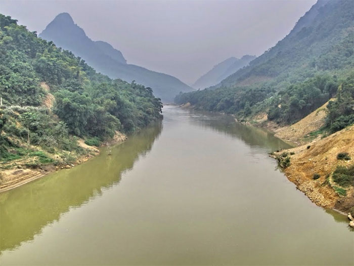
The Mã River flows mostly through mountainous forest and midland areas.
The Mã is a river of Vietnam and Laos, 512 km long, of which 410 km lies in Vietnam and 102 km in Laos. Its basin covers 28,400 km², with 17,600 km² in Vietnam; the average elevation is 762 m, the average slope 17.6% and the drainage density of the whole basin 0.66 km/km². Average annual discharge is 121 m³/s at Xã Là and 341 m³/s at Cẩm Thủy. The Mã flows mostly through mountainous forest and midland areas. Its alluvium is the main source of the Thanh Hóa plain, the third largest in Vietnam. The river runs along the depression between the Su Xung Chảo Chai and Pu Sam Sao ranges, where most of its tributaries rise.
The Mã begins at the confluence of streams in the Vietnam–Laos border area at Mường Lói commune, in the south of Điện Biên district (southern Điện Biên province), at 21°0′49″N 103°7′38″E. Pu Lau village, north of Mường Lói, sits on a ridge forming the watershed between the Nậm Nứa, which flows northwest and belongs to the Mekong system, and the Nậm Ma, which flows northeast and is the headwater of the Mã, known locally as the Sẻ stream. The river then flows into Điện Biên Đông, receiving water from several streams at Háng Lìa, Điện Biên Đông, along the way.
The river re-enters Vietnam at the Tén Tằn border gate, Mường Lát, Thanh Hóa. From there it flows through Mường Lát and Quan Hóa, where a short stretch in Quan Hóa district forms the boundary between Thanh Hóa and Hòa Bình provinces. The Mã river system has a total length of 881 km and a total basin of 39,756 km², of which 17,520 km² lies in Vietnam. The average annual water volume of the whole system is 19.52 billion m³.
5. Lam River (Cả River)
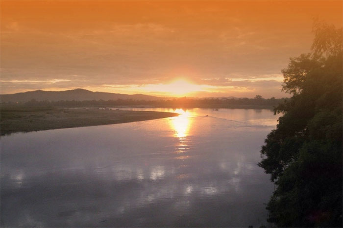
The Lam is one of the two largest rivers in Vietnam's North Central region.
The Lam River (also called Ngàn Cả, Cả River, Nậm Khan or Thanh Long Giang) is one of the two largest rivers in Vietnam's North Central region. It rises on the Xiangkhouang Plateau in Laos. The part flowing through Laos is called the Nam Khan. The main part of the river flows through Nghệ An; its final stretch joins the La River from Hà Tĩnh, forming the boundary between Nghệ An and Hà Tĩnh, and empties into the sea at Cửa Hội.
According to the Vietnamese Encyclopedia, the river's total length is about 512 km, of which about 361 km lies within Vietnam. Other sources, however, say the river has two main sources: measured from the Nậm Mơn (in the Pu Lôi range) the Lam is 530 km long, while measured from the Nậm Mô (on the Trấn Ninh, or Xiangkhouang, Plateau) it is 432 km long. Its basin covers 27,200 km², of which 17,730 km² lies in Vietnam.
Averaged over its whole course, the Lam lies at an elevation of 294 m with an average slope of 18.3%. Its drainage density is 0.60 km/km². From the Vietnam–Laos border to Cửa Rào, the riverbed is steep, with more than 100 rapids. Downstream of Cửa Rào, small boats can navigate the river in the high-water season. The total water volume of 21.90 km³ corresponds to an average annual discharge of 688 m³/s and an annual runoff modulus of 25.3 l/s.km². Average annual discharge is 236 m³/s at Cửa Rào and 430 m³/s at Dừa. The flood season, from June to November, is also the rainy season and contributes about 74–80% of the year's total flow.
6. Lô River
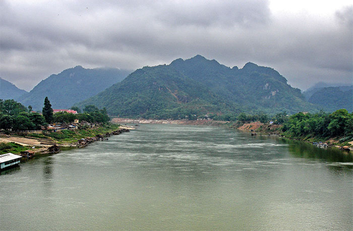
The stretch of the Lô River in Vietnam is 274 km long.
The Lô is a first-order left-bank tributary of the Red River, flowing from China into Hà Giang, Tuyên Quang and Phú Thọ provinces in Vietnam. Its Vietnamese stretch is 274 km long (various books give figures from 264 km to 277 km), making it one of the five longest rivers in northern Vietnam (the Hồng, Đà, Lô, Cầu and Đáy).
On the 156 km stretch from the Việt Trì confluence to Tuyên Quang port in Tuyên Quang province, vessels with a load capacity of 100 to 150 tonnes can operate in both seasons. From Tuyên Quang city to Hà Giang city, small vessels can carry cargo during the rainy season.
7. Mekong River
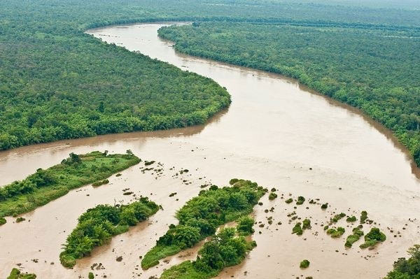
The Mekong rises on the Tibetan (Qinghai–Tibet) Plateau in China.
The Mekong is one of the largest rivers in the world. It rises on the Tibetan (Qinghai–Tibet) Plateau in Qinghai province, flows through China, Laos, Myanmar, Thailand and Cambodia, and empties into the East Sea in Vietnam. It ranks 12th in the world by length, at 4,350 km, and 10th by discharge. Average discharge is 13,200 m³/s and can reach 30,000 m³/s in the flood season. Its basin covers about 795,000 km² (according to the Mekong River Commission). The river starts in the high mountains of Qinghai, crosses Tibet and runs the full length of Yunnan province (China), then passes through Myanmar, Thailand, Laos and Cambodia before entering Vietnam.
From Phnom Penh it splits into two branches: on the right the Bassac (called the Hậu Giang or Hậu River in Vietnam) and on the left the Mekong (called the Tiền Giang or Tiền River in Vietnam). Both flow into the vast delta of southern Vietnam, each roughly 220–250 km long. In Vietnam, the Mekong is also called the Lớn River or Cái River.
The World Wide Fund for Nature (WWF) says scientists are searching the Mekong for creatures such as sea catfish, catfish, giant freshwater stingrays, needlefish and large carnivorous carps — fish that can weigh more than 90 kg and grow longer than 1.80 meters. The Mekong is also home to rare goonch catfish (cá chiên) and Hemibagrus catfish (cá lăng), not to mention the giant barb (cá hô) and giant carps, so fishing tourism is thriving here.
8. Chảy River
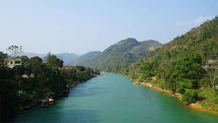
The Chảy River's flow is highly complex, with a narrow, deep channel, steep banks and many rapids.
The Chảy is a river in northern Vietnam. It rises on the southwestern slope of Tây Côn Lĩnh peak (2,419 m) and the northeastern slope of Kiều Liên Ti peak (2,402 m), in the mountain massif at the head of the Chảy in northwestern Hà Giang province, crosses Lào Cai and Yên Bái provinces, and flows into the Lô River at Đoan Hùng, Phú Thọ province, over a length of 319 km.
The river's flow is highly complex, with a narrow, deep channel, steep banks and many rapids. In Hà Giang province it flows east to west through Vị Xuyên, Hoàng Su Phì and Xín Mần districts, then through Si Ma Cai district in Lào Cai province. On this stretch, about 5 km of the Chảy forms the Vietnam–China border between Lào Cai province and Yunnan province, China.
The Chảy River is a stunning natural attraction for lovers of ecotourism. In the low-water season the deepest point of the river is only about 3 m, so you can sit in an iron boat and travel upstream sightseeing to your heart's content. Scattered along both banks are the simple houses of the Hmong, Dao and Giáy peoples... Now and then you may also come across bamboo rafts bobbing on the water as they dredge sand, while in the distance the road up to Bắc Hà looks like a streak of white lime draped across the mountainside.

Expert explains the funnel-shaped vapor trail in the sky over Thanh Hóa
A strange vapor streak seen near the horizon over the former Hậu Lộc district in Thanh Hóa, Vietnam, was caused by jet engine exhaust, experts say.

How do the lunar and solar calendars differ?
The lunar calendar is a key part of East Asian tradition. Here is how it differs from the solar calendar and why it matters in Vietnam.
Could humans live underground to escape climate change?
Is living underground a viable solution to an approaching climate crisis? Scientists weigh the benefits and the risks.
Where women paint their nails, wear traditional robes and take spears to the sea to hunt squid
Oman's Bedouin women fishers hunt cuttlefish, rays and octopus with simple handmade spears, but their tradition may be dying out.

Fascinating fact: The University of Oxford is older than the Aztec civilization
Did you know that the University of Oxford is more than 200 years older than the mysterious ancient Aztec civilization?

Vietnamese scientists resolve a microalgae mix-up that lasted more than a century
Vietnamese researchers have re-described the dinoflagellate Ostreopsis siamensis, ending more than 100 years of taxonomic confusion.